Google Maps calculates Moroccan driving times using maximum statutory highway speed limits without accounting for reality on the ground: single-lane mountain switchbacks over 2,260-meter passes, slow-moving phosphate trucks, agricultural tractors, Gendarmerie radar checkpoints, and livestock crossings. For mountain and desert routes (such as Marrakech to Merzouga or Fes to the Sahara), always add 25% to 40% to Google Maps' estimates to calculate realistic, comfortable journey times.
Open Google Maps, punch in "Marrakech to Erg Chebbi Dunes, Merzouga", and the screen comfortably returns: 8 hours and 35 minutes (560 km). It seems ambitious, but doable in a single day—or so hundreds of exhausted travelers mistakenly believe each week.
In reality, attempting this marathon sprint turns what should be an enchanting cultural crossing of North Africa into a grueling 11-hour endurance trial. By the time you navigate the hairpin bends of the High Atlas, crawl behind heavy lorries, clear rural police checkpoints, and stop for coffee and fuel, the sun has vanished beneath the horizon. You miss the golden sunset camel trek into camp, arriving exhausted in pitch darkness.
At Roam Morocco, our chauffeurs navigate these mountain passes weekly. In this authority guide, we break down the exact realistic driving times between Morocco’s primary destinations, why digital maps mislead you, and how to structure your 10-day Morocco road trip to savor every mile.
Morocco Driving Times: Google Maps vs. Realistic Chauffeur Time
Below is our ground-tested reality matrix comparing theoretical digital estimates against actual travel times with comfort stops, scenic photo opportunities, and standard mountain conditions:
| Circuit Route | Distance (km) | Google Maps Time | Realistic Travel Time | Key Bottlenecks & Passes | Recommended Pacing |
|---|---|---|---|---|---|
| Marrakech → Merzouga (Sahara) | 560 km | 8h 30m | 10h 30m – 11h 30m | Tizi n'Tichka Pass (2,260m), Ouarzazate, Tinghir town traffic | Mandatory 2-Day Split (Overnight in Dades/Skoura) |
| Marrakech → Dades Valley / Skoura | 310 km | 5h 45m | 6h 30m – 7h 00m | Tizi n'Tichka switchbacks, Ait Benhaddou detour | Comfortable Day 1 of Sahara Expedition |
| Dades Valley → Merzouga Dunes | 260 km | 4h 00m | 5h 00m – 5h 30m | Todra Gorge walk, Tinghir souk, Erfoud date oasis | Perfect Day 2: Arrive at camp by 4:30 PM for sunset |
| Fes → Merzouga (Erg Chebbi) | 465 km | 7h 15m | 8h 30m – 9h 00m | Middle Atlas cedar forest, Col du Zad, Ziz Gorge | Feasible in 1 long day with early 7:30 AM departure |
| Marrakech → Fes (Direct Highway) | 530 km | 5h 45m | 6h 30m – 7h 00m | A1 Toll Highway via Casablanca bypass | Fastest connection; better done via Al Boraq train + driver |
| Marrakech → Essaouira (Coast) | 190 km | 2h 45m | 3h 15m – 3h 30m | Chichaoua junction, argan tree photo stops, speed radars | Ideal day trip or 2-night coastal retreat |
| Tangier → Chefchaouen (Blue City) | 115 km | 2h 15m | 2h 45m – 3h 00m | Rif Mountain bends, Tetouan bypass | Scenic mountain drive; beautiful morning transit |
| Fes → Chefchaouen | 200 km | 3h 45m | 4h 30m – 5h 00m | Winding N13 secondary highway, farm traffic | Requires alert driving; stunning green rolling hills |
Can You Drive From Marrakech to Merzouga in One Day?
DIRECT LOGISTICS VERDICT // MARRAKECH TO SAHARA
No, you should never attempt Marrakech to Merzouga in a single day. While mathematically possible if you drive nonstop for 11+ hours without meals, you will miss Morocco’s most iconic highlights (the UNESCO Ksar of Ait Benhaddou, the Rose Valley, and Todra Gorge) and reach the desert in total darkness. The luxury standard is a 3-day / 2-night or 4-day / 3-night circuit with an overnight in a Skoura palm grove or Dades Valley kasbah.
The journey from Marrakech to Erg Chebbi crosses the High Atlas via the legendary Tizi n'Tichka pass (elevation 2,260 meters / 7,415 feet). This engineering marvel climbs through dramatic red-rock canyons and Berber hamlets. However, because it is the primary arterial freight link between Marrakech and southeastern Morocco, you will constantly encounter loaded trucks climbing at 20 km/h on steep inclines.
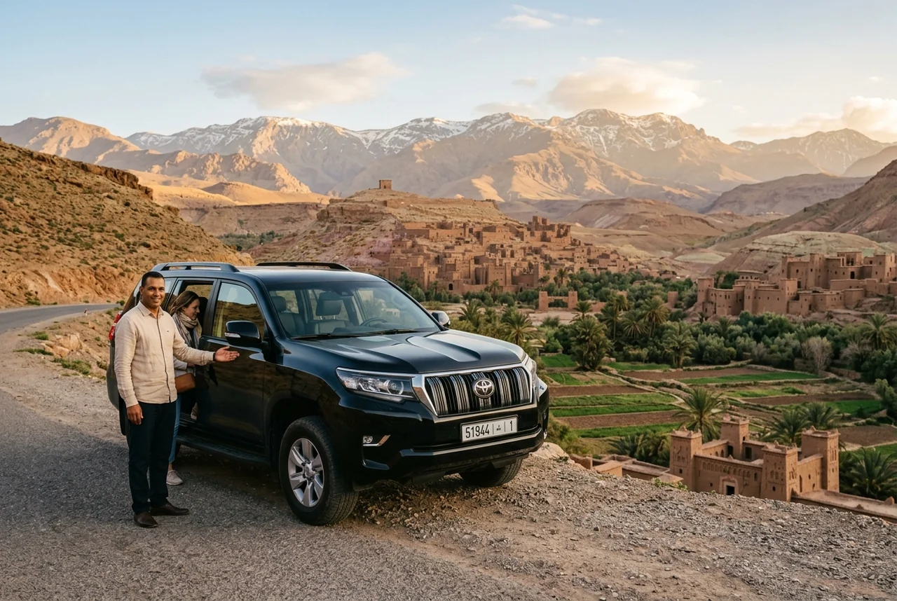
Passing requires patience, clear visibility, and an engine with strong low-end torque—which is why our fleet relies exclusively on heavy-duty Toyota Land Cruiser Prado 4x4s and executive Mercedes-Benz tour vans.
The Ideal 3-Day Marrakech to Sahara Route Breakdown
- Day 1 (Marrakech → Ait Benhaddou → Skoura/Dades): Depart Marrakech at 8:00 AM. Cross Tizi n'Tichka. Tour the ancient mud-brick citadel of Ait Benhaddou (featured in Gladiator). Relax at a boutique valley kasbah by 5:30 PM. Drive time: ~6.5 hours.
- Day 2 (Dades Valley → Todra Gorge → Merzouga Dunes): Stroll through the sheer 300-meter limestone cliffs of Todra Gorge. Stop in Erfoud for fossil workshops and sweet Medjool dates. Arrive at the edge of Erg Chebbi by 4:00 PM for tea, luggage transfer, and a sunset camel caravan into your luxury desert camp. Drive time: ~5 hours.
- Day 3 (Merzouga → Fes OR return to Marrakech): Depart after breakfast. If heading to Fes, enjoy the scenic Middle Atlas crossing via the Ziz Gorge and cedar forests of Azrou. Drive time: ~8.5 hours.
The 5 Factors That Make Digital Maps Inaccurate in Morocco
1. The Tizi n'Tichka Mountain Reality
Algorithms assume you can navigate hairpin mountain turns at the posted 60 km/h limit. In reality, winding switchbacks, altitude changes, and heavy vehicles reduce average speeds over the pass to 35–45 km/h.
2. Gendarmerie Royale Speed Checkpoints
Morocco takes road safety seriously. As you approach nearly every town or roundabout, you will encounter stationary Royal Gendarmerie checkpoints marked by "HALTE CONTRÔLE" signs. You must decelerate to 20 km/h, come to a near stop, and await an officer's hand wave before proceeding. Over a 500-kilometer drive, these checkpoints add 30 to 45 minutes of cumulative deceleration.
3. Agricultural Traffic & Rural Pedestrians
In rural provinces like Errachidia, Tinghir, and Zagora, the national highways serve as the lifeblood of rural life. You will frequently share single-lane roads with donkey carts, herd boys moving sheep, and vintage tractors hauling olive or date harvests.
4. Medina Navigation & Luggage Hand-offs
Google Maps does not understand that cars cannot enter Moroccan medinas. When you arrive in Marrakech, Fes, or Chefchaouen, the car ride ends at the nearest medina gate (Bab). Navigating parking, meeting riad staff, and hauling luggage through medieval alleys can take 30 to 60 minutes beyond the map’s arrival timestamp.
5. The Importance of Scenic Unhurried Stops
Morocco is not a destination to rush through a windshield. You will want to stop to photograph mountain panoramas, sip mint tea at roadside Berber cafes, and savor slow tagines for lunch. A road trip without stops is a missed journey.
Self-Drive vs. Private Chauffeur: Which Is Better for Mountain Routes?
Many travelers ask whether they should rent a car or hire a local driver. While renting a car is feasible for modern toll highways between Casablanca, Rabat, and Tangier, the mountain and desert circuits present a completely different set of challenges.
For a complete breakdown of vehicle pricing, insurance traps, and driver daily rates, explore our companion guide: How Much Does a Private Driver in Morocco Cost? (2026 Price Guide).
Why Luxury Travelers Choose Private 4x4 Chauffeurs for Desert Circuits
- Zero Navigation & Radar Stress: Eliminate arguments over navigation apps and never worry about French-language police citations.
- Superior Safety & Ground Clearance: High-clearance 4x4 Toyota Prados handle washboard gravel tracks and flash flooding easily compared to cheap rental compacts.
- Cultural Ambassadors: Your chauffeur translates Darija and Berber at local markets, recommends authentic uncommercialized eateries, and coordinates luggage directly with your riad.
- Door-to-Door Peace of Mind: Relax, take photos, and absorb the breathtaking scenery rather than white-knuckling mountain cliff edges.
Frequently Asked Questions: Morocco Driving Times
Is driving at night safe in Morocco?
We strongly advise against nighttime driving on rural and mountain roads. Many rural roads lack street lighting, and unlit carts, pedestrians, and livestock frequently share the roadway. Roam Morocco private tours are strictly scheduled so that all mountain transits conclude before twilight.
What is the speed limit on Moroccan highways?
On designated toll expressways (Autoroutes), the speed limit is 120 km/h. On open rural national roads (Routes Nationales), it is 100 km/h, dropping to 60 km/h or 40 km/h through towns, villages, and checkpoints. Speed radars are frequent and strictly enforced.
Does the Tizi n'Tichka pass close in winter due to snow?
Occasionally during intense winter storms between late December and February, the summit at 2,260m may experience heavy snowfall causing temporary closures of 2 to 6 hours while Moroccan road snowplows clear the highway. Our operations team monitors national road bulletins continuously to adjust departure times accordingly.
Experience Morocco at the Perfect Pace
Let Hamza and Roam Morocco's veteran chauffeur team curate your seamless private journey across the High Atlas, Sahara dunes, and Imperial Cities.
Design Your Custom Circuit →